Showing posts with label Reading List. Show all posts

Wednesday, May 23

Edward Murray Bassett and the Origins of Zoning

The following is a summary of and reflection on Zoning by Edward Murray Bassett, published by the National Municipal League in 1922. After writing the first comprehensive zoning ordinance for New York City six years earlier, Bassett had become the preeminent authority in the U.S. on this emerging land use tool. This is his case to cities for adopting a zoning code.

Zoning has become so ubiquitous in American cities that nobody bothers to defend the practice anymore. Steady rounds of critiques have been launched against zoning from all sides, from social justice proponents decrying exclusionary practices, to private property rights groups leveling against government intervention, to public policy academics, to urbanists and environmentalists opposed to strict separation of uses and controls on density. However, for the most part, mainstream zoning codes have been very resistant to these attacks over the years. Not much has changed, and, in fact, there are even very few general counterarguments made in defense of traditional zoning, at least that I'm aware of. It's just the way we do things.

This is why it's instructive to read an early planner who argued passionately for the creation of zoning codes. In 1922, there were only sixty codes in place in American cities, and Edward Murray Bassett made a compelling case for many more states to allow this new practice. I've pulled together the primary arguments he made in favor of zoning, many of which still apply today:

1. Cooperation yields overall larger return on investment for all property owners. This was Bassett's primary concern, one that he underscored with a number of prisoners' dilemma scenarios. For example, "In some of the larger cities a landowner in the business district is almost compelled to put up a skyscraper because if he put up a low building, his next neighbor would put up a higher one that would take advantage of his light and air." He asserted that skyscrapers were probably not a sound investment in their own right, but they were built anyway in a virtual arms race for public goods of light, air, privacy, and scenery. Zoning was the truce that made everyone better off.

2. Zoning stabilizes building and property values, by signaling to investors what they can expect from a certain district. Markets work when people know what they are buying, and zoning creates some assurance that the product will not change fundamentally. This reason is why housing developers were among the most ardent supporters of zoning in the early stages.

3. Constitutional limits on local "police powers" would prevent zoning excesses, so residents need not worry about a slippery slope toward regulating "aesthetics and sentimentality" (more on this below).

4. Zoning is better than deed-restrictions, which were already being used to accomplish a similar purpose. Unlike the latter tool, zoning is applied comprehensively and can be adjusted by elected bodies to meet evolving needs.

5. Zoning is better than nuisance law. Without a zoning code in place, disputes between property owners about impacts can only be settled through common law nuisance claims. This is more expensive and arbitrary than zoning. 

6. Zoning prevents the wealthy from leaving the city. By 1922, the trend toward suburbanization was well underway. Bassett advised cities to zone for the kinds of low-density neighborhoods the wealthy were seeking, in order to prevent them from moving further out and losing the tax base. (This is reminiscent of a contemporary argument that cities must provide free downtown parking, in order to prevent shoppers from taking their business to the suburban big boxes).

7. Zoning limits land speculation by eliminating the possibility for large-scale buildings in low-density zones. Bassett writes, “Owners of vacant corner lots, that had been held out of use so that apartment houses might be built, have in almost every case improved them as high-class one-family residences.” (ok ... I don't buy this one. There would seem to be counterexamples that go the opposite direction)

8. Zoning maximizes public infrastructure investment.  Major thoroughfares create natural businesses districts by giving access to numerous customers. However, if homes or other less suitable uses are built on major streets, the full economic impact of the public infrastructure is not achieved.

9. Zoning manages and stabilizes growth. He wrote, “Zoning encourages growth while at the same time it prevents too rapid changes.” A good code would lead to steady growth, without any expanding or deflating real estate bubbles. This would also facilitate reasonable planning of public infrastructure and facilities.

Notice the complete absence of social, moral, or ideological language. These are not the words of a utopian academic envisioning the city of the future, but rather a politically-astute pragmatist addressing a chamber of commerce or some other worldly audience. Bassett deliberately distanced himself from any "radical experimentation" even while presenting what was on the regulatory cutting edge of the time. Unlike some previous planners, he did not present zoning as a tool for class segregation. He didn't even really mention class, or housing conditions, or city beautification, or any of the other movements popular at the time. His focus was squarely on return on investment.

But Bassett issued a very interesting caution - tucked into the middle of a paragraph - that gives some insight into an appropriate purpose and scope for this tool. He advised cities not to pass zoning that explicitly forbids apartment buildings in single-family home zones, instead favoring one broad residential zone for all types of housing (he thought setback and height limitations could be used to achieve the same effect).

Bassett was certainly not worried about concentrating poverty or perpetuating sprawl, as we might be today. He was concerned that the courts would throw out such regulations as a breach of the constitutional power to protect "health, safety, morals, and general welfare." If this happened, he believed it would have a chilling effect for all cities, causing an over-reaction that could very well have killed zoning in its infancy.

We have to remember that the courts were still probing exactly how far land use regulations legally could go. As a father of a toddler, I can relate to the series of tests it takes to establish the exact meaning of something as simple as "don't smash your carrots." It took the U.S. Supreme Court decades to test the meaning of local police powers to control land use. First, the court allowed building height regulation in Boston, then setback regulation in Richmond, then regulation of industrial uses in Los Angeles. Bassett was heartened by these successes, but he didn't want to push his luck.

The Village of Euclid, Ohio passed their zoning ordinance just as Bassett published this pamphlet, leaving them without the benefit of his cautionary advice. Their ordinance did, in fact, prohibit multifamily buildings entirely from single-family districts, and the Supreme Court Justices paid special attention to this fact during the landmark Village of Euclid v. Ambler Realty Co. case. Prohibiting a smokestack next to a school is one thing, but would allowing different housing types to share a district really detract from the health, safety, or welfare of the public?

Yes, as it turns out. Bassett was wrong. The court upheld Euclid's code, thereby granting more power to zoning than he had anticipated. From the opinion of the court delivered by Justice Sutherland, at length:
"With particular reference to apartment houses, it is pointed out that the development of detached house sections is greatly retarded by the coming of apartment houses, which has sometimes resulted in destroying the entire section for private house purposes; that, in such sections, very often the apartment house is a mere parasite, constructed in order to take advantage of the open spaces and attractive surroundings created by the residential character of the district. Moreover, the coming of one apartment house is followed by others, interfering by their height and bulk with the free circulation of air and monopolizing the rays of the sun which otherwise would fall upon the smaller homes, and bringing, as their necessary accompaniments, the disturbing noises incident to increased traffic and business, and the occupation, by means of moving and parked automobiles, of larger portions of the streets, thus detracting from their safety and depriving children of the privilege of quiet and open spaces for play, enjoyed by those in more favored localities -- until, finally, the residential character of the neighborhood and its desirability as a place of detached residences are utterly destroyed."
(Of course, if you happened to live in one of those parasites that lead to a chain reaction of utter destruction, it's not clear how your own welfare is benefited by this ruling in any way.)

Euclid could easily have gone the other way. The Ohio Federal District Court previously struck down Euclid's zoning, declaring "in the last analysis, the result to be accomplished is to classify the population and segregate them according to their income or situation in life." A Euclid loss would have still allowed certain form-based regulations and limitations on industrial uses, but broader land use regulation would have been severely chastened. Bassett was probably right to doubt the odds of a victory in 1922, but the number of zoning ordinances had grown exponentially in just five years. The Justices hearing the Euclid case were reminded of the 24 million U.S. residents living under a democratically-imposed zoning code as they weighed the allowable extent of this power.

I have not been able to find Bassett's reaction to the Euclid decision, but it raises an interesting question. Was he relieved that the zoning he fought so hard for passed its most important test of constitutional scrutiny? Or was he concerned that this power was being taken too far? After all, the constitutional protection against excesses was one of his original selling points of zoning:
"Zoning must be done in relation to the public health, safety, morals and general welfare. If it is done arbitrarily or by whim or for aesthetics or for purely sentimental purposes or with unjust discrimination, the courts will not uphold it."
I'd like to think that Bassett, at least in some honest moments, felt a little like Dr. Frankenstein. He had persuasively (to me at least) argued for a community's responsibility to form some order out of chaos, only to see zoning grow to reinforce the benefit of "favored localities" at the expense of others. He wrote that zoning "should follow nature and it should not be forgotten that the city has a history," yet this tool had begun to artificially restructure the 20th century city into a form never before seen. He had expected the courts to be a bulwark against taking this power too far. But that did not happen.

Tuesday, March 20

Review of Lasting Value

A vibrant city and a healthy countryside are vitally interrelated, or at least they should be. This is one of the conclusions reached by Rick Preutz in the new book Lasting Value from APA Planners’ Press. The author meticulously evaluates twenty-five communities around the United States that are considered successful in preserving land for recreational parks, agricultural, and protection of ecosystems. Beyond simply presenting an inventory of achievements – although it does, down to the acre – the book explores why these policy objectives came into being and how they have been carried out.

As I read through the stories of communities working to protect their natural heritage, one striking fact kept reinforcing itself over and over again. The methods and motivations for land preservation are as varied as the Everglades is from the front range of the Rockies. Localities across the country have arrived at similar conclusions from vastly different starting points, belying the notion of a monolithic environmental movement driving policy forward over the decades.

Let’s start with who the actors are. In the public sector, actions range from local governments purchasing open space through bonds to federal acquisition of park or managed land. The private sector, especially in the form of community land trusts, plays an important role, sometimes partnered with governmental agencies and sometimes operating on an independent, parallel track. What’s interesting is the interplay between all of these scales. Point Reyes National Seashore was borne out of grassroots advocacy at the community level that bubbled up all the way to Congress. In Pima County, Arizona, the story played out in reverse. The county purchased land from the federal Bureau of Land Management that would likely have been sold to developers, in order to place the lots under easements as ranchland.

The motivations behind land preservation also vary significantly. I appreciate how Pruetz, instead of simply listing a rote set of benefits textbook-style, presents real situations in which a message resonated loudly enough to result in action. Lexington-Fayette County, Kentucky, seeks to maintain their tradition as a horse-breeding region. Lancaster County, Pennsylvania, values their farming heritage and the tourist revenue it generates. Minneapolis, Minnesota, wants a fully connected greenway encircling the metro area for recreation. Collier County, Florida, wants to preserve a unique wetland ecosystem. Burlington County, New Jersey, needs to protect an aquifer vital to a large population. And everyone, to some degree, understands the cost savings of avoiding inefficient installation of public services. It’s clear that each place has driven preservation through values conjured up from within, rather than imposed from outside by an abstract ideology or large institution.

And then there are the tools. The complex cocktails of preservation policies and programs gives some insight into how folks like Preutz can make a career out of guiding localities through it all. Boulder County, Colorado has no less than ten distinct programs targeted toward protecting recreational open space and productive ranchland. The author has a clear preference for permanent preservation over regulatory approaches, such as zoning or other land use controls, which I suppose should be obvious with the choice of Lasting Value as a title. Zoning can be changed in a single election cycle, but an easement or purchase of public land is usually effective in perpetuity (as long as easements are enforced, a limitation the book doesn’t really address).

While Lasting Value is likely to inspire those who are already committed to conservation, it does not, in my mind, adequately lay out all of the costs associated with many of the policies described. There are several criticisms that have been lodged against these, and some consideration of the possible pitfalls, in addition to the clear benefits of land conservation, could help decision-makers determine when the use of a tool is appropriate and what side-effects may need to be mitigated.

Housing affordability is an important issue, considering a few back-of-the-envelope calculations. In 2010, the median home value for all metropolitan areas in the U.S was $217,121, which was 4.16 times the median metro income. However, the median home value of counties recognized for preservation in the book was $293,776, or 5.46 times the somewhat higher median income of these areas. This fact alone doesn't point to causation, but see recent Kindle singles by urbanists Matthew Yglesias and Ryan Advent for some explanation on the effects certain limits on development have on housing costs and urban form. I don't believe this is a fatal flaw of land preservation, but it does highlight some consequences of putting more emphasis on where not to build than on encouraging development in the right places.

I'll focus the rest of this post on a critique of Transfer of Development Rights (TDR), because this tool figures so heavily in the communities profiled. TDR is presented as a means for protecting rural land without incurring public cost, but there are some hidden costs to think about. Once again, I don't intend this to be a wholesale dismissal of the tool in all cases, but only a caution to add. See also this report from the Weldon Cooper Center on the pros and cons of the policy.

In a nutshell, A TDR policy designates a sending area, where development is to be discouraged, and a receiving area, where the community would like to allow more residential growth. Developers are then allowed to purchase the right to develop in the receiving area from landowners in the sending area. The transaction is made on an open market at some predetermined ratio, such as one development right for five acres in Montgomery County, Maryland. In exchange, the seller agrees to place their land under a conservation easement.

However, in order to create the conditions for a market in development rights, density must be restricted by zoning in the receiving area – the place where growth is supposedly desired. Although this may seem counter-intuitive, it is necessary to provide an incentive for developers to pay for the right to exceed the requirement. After all, the value of a development right, to a buyer, is exactly the perceived difference in value between what a developer is currently allowed to build and what the right will allow, and this value needs to be high enough to make a sale worthwhile to the rural landowner. Otherwise, the whole system is just a few pages of code in a book on the shelf.

There are a few problems with artificially restricting density in urban areas, in order grease the wheels of the market. The developer may simply choose to sidestep the whole process and build according to the legal low-density allowance. This is a lose-lose-lose game of chicken. If this happens no rural land is preserved, the landowner and developer are not able to maximize their investment, and urban areas are squandered with inappropriately scaled development. Nobody desires this outcome, but the risk of it occurring, particular during times of economic hardship, should be taken into account.

Secondly, when the transfers do happen, they cost the public in "leverage" over development. What does this mean? Suppose a developer does decide to work with a locality in order to exceed density restrictions in the receiving area. Depending on the state, there are a number of concessions the developer could offer. They could deed-restrict a few units for affordable housing, create a bike and pedestrian trail to connect other neighborhoods, use community-supporting urban design, or build basic infrastructure to support the development. Often, a developer will be willing to stretch further to create on-site amenities that also directly benefit the project's bottom-line. However, if the developer could achieve the desired result with the purchase of a development right, all of these negotiations are bypassed and none of these benefits to the neighborhood come to fruition.The end result can be seen as a transfer of resources away from urban neighborhoods and into the accounts of individual rural landowners.

Lasting Value is a thorough and well-documented portrait of the success stories in land preservation, although the book would be improved by a broader definition of success that takes into account how the benefits and costs/risks of conservation have been distributed throughout the community.

Monday, November 28

In Search of the Megapolitan Scale

When Jean Gottmann popularized the term Megalopolis in the 1960's, he mostly had the Northeast Corridor in mind. By this time, so many interconnections had developed between the string of cities from Boston through Washington DC that it could be referred to as a single unit. Arthur Nelson and Robert Lang, two noted planning academics, continue this line of reasoning in their new book  Megapolitan America, only now highlighting eleven Megapolitan Clusters around the United States. While this nation is a very large one spatially, a significant chunk of economic activity, real estate development, and innovation takes place on only 17% of the privately-held land area. The authors argue that this reality should effect how we conceive of ourselves as a nation.

This is more than just a battle over geographic nomenclature. Once the boundaries of regions are widely accepted, they can define the scale of public and private activities and shape the impact of these activities. The cities of Dallas and Fort Worth formed with completely separate self-images, until a short while after the Census Bureau labeled them a single metropolitan area based on a quantitative definition. The change triggered an adjustment in the federal aid formula used by the FAA, and the two cities were compelled to cooperate on the construction of a single airport. This launched a string of practical joint actions, out of which the single identity of "Metroplex" emerged - the result of a convergence of both top-down and bottom up forces.

So how do you find a Megapolitan Area? If urban systems are dynamic, the boundaries of Megapolitan Areas must be defined by movement. This is a fundamental insight Nelson and Lang adopt from Gottmann and decades of Census Bureau practice. It may be tempting to define regions by drawing a circle around concentrations of stuff, whether population (where people sleep at night) or employment (where those who work in a fixed place spend a large portion of their week), but the movement of people, goods, water, animals, energy, and whatever you can think of through space is what connects places together.

The authors use commuting data to define the shape of Megapolitan Areas, mostly because it's readily available. This works as a proxy but it also misses a majority of human movement, even most work-related travel, since our daily travel patterns are becoming more diffuse and harder to define on a two-point scale. What if you travel to the local office three days a week, work from home sporadically, and visit the regional headquarters a few times a month? Here's where Google or Apple could step in. They've both been amassing huge databases of personal locational information from smartphone users, at least those who have opted in. You can imagine meandering lines on a map, one for each individual path, crisscrossing into a jumbled mess. What most resembles a massive hairball? There's your Megapolitan Area.

If Megapolitan Areas are defined as such by numbers, they remain that way with a story. Nelson and Lang use the apt word "organic" to describe a region that captures the public imagination by tapping into an already understood sense of place. Language is notoriously hard to dictate by fiat, which is why Americans still measure temperature in Fahrenheit. Even if the Census Bureau is convinced to create a new category for megapolitan areas - and the book makes a good case for it - the label will not have much currency until it is accepted by media outlets and the general public in each individual community. They also need a catchy name.

Two very different prognoses for the Sun Corridor
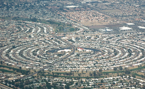
Much of the book focuses on projecting population growth and development out to 2040, in order to predict the continued importance of Megapolitan Areas well into the 21st century. Suffice it to say that the authors are pretty bullish on American growth, expecting it to continue in roughly the same trajectory it has been on for the last several decades, not withstanding our major housing hiccup. Seeing that Las Vegas and the Sun Corridor (Phoenix to Tucson) are slated to be among the fastest growing regions brought to memory an image from a couple of weeks ago. James Howard Kunster was addressing the CityWorks (X)po in Roanoke, Virginia. He showed an aerial photo of houses stretching into the Arizona desert, then quickly remarked, "oh yeah, and Phoenix is toast. There will be no Phoenix" before moving on to the next slide.

So what do you do when two people whom you respect differ in their forecast by ... oh, nine million or so? Well, you cut the difference. Kunstler is clearly being hyperbolic. There's too much vested capital in these Megapolitan Areas for even the worst-case scenario to simply erase them. On the other hand, Nelson and Lang could stand to internalize the possibility of resource scarcity into their projections. They've written a whole chapter on the pressure megapolitan growth will exert on farmland, water, and air quality, but they don't seem to accept that these pressures, in turn, will shape the built environment in a measurable way. For example, the authors point out that water use in the dry Sun Corridor, which is the highest per household in the nation, will have to be reduced somehow. But will those restrictions curtail business? Will future sunbirds be deterred if they can't have the lawn promised in the brochure? That's easy ... yes. Growth will slow down.

But quibbling about the exact distribution of population would be missing the point of the book, and the authors are appropriately cautious in the epilogue with looking so far into the future. The question is whether the definition of Megapolitan Areas will continue to accurately reflect the American pattern of development into the future. Charles Darwin noticed two kinds of taxonomists, the "lumpers" who saw few species and the "splitters" who saw many species. Likewise, reasonable people could look at the same Megapolitan Areas and see many metropolitan areas connected to each other rather than a single whole. Or even a whole galaxy of neighborhoods and employment centers.

This is not a problem. Really, we need as diverse a taxonomy as we have problems to apply it towards. The authors make a strong case for using the megapolitan scale for planning national rail infrastructure, which fits nicely because of the needed density and optimal range inherent to this technology. Some economic development efforts, at least for global markets, would work well at the megapolitan scale, but in other regional markets businesses and communities would be better served by competing with each other.

However, there are points in the book where it feels like the Megapolitan scale is being championed as a superior way of dividing up the nation, rather than just another tool with some good applications. I'm personally very fond of the terms "urban" and "rural" and everything they connote, so it would be sad to see these traditional distinctions melted away into one big megapolitan stew. After all, it's just as legitimate to use labels on the basis of how we want the world to be than on how it currently is. Megapolitan Areas also have the liability of not being exhaustive, which makes the old-fashioned state boundaries more appropriate for applications where complete inclusiveness is necessary.

I'm happy to think in terms of Megapolitan Areas and use the term in the way Nelson and Lang present it, along with several other geographical constructs that have their own appropriate uses.

Thursday, October 20

Instant City: Life and Death in Karachi

Reading a book by an NPR host is a different kind of experience. So was the case with Instant City: Life and Death in Karachi. As Steve Inskeep shares his impressions of Karachi's explosive urban growth, I could almost hear the subtle enthusiasm in his voice over the crunches of granola in my mouth. Fortunately, his skill for parring down complex subjects into bite-sized remarks translates well onto the written page.


Something like a city-wide version of Maslow’s hierarchy of needs shows up in various forms throughout the tale of Karachi’s growth. Faced with an ongoing tidal wave of immigrants from rural areas, urban planners and developers alike tried over the years to shape that growth into a desired form. However, in the absence of more basic government services such as security, sanitation, and public infrastructure these higher-level organizational schemes had no chance of actually working. If prospects did seem good for a moment, the regime would change and it would be all over.  In many cases, city officials and businessmen would import ideas from the West, often directly through global consultants, without paying enough attention to the very different political reality on the ground in Karachi.

The 50-year-old suburbs of Korangi and North Karachi are apt examples. Inspired by the West’s suburban expansion in the 1950s, Pakistan’s ruling general Mohammad Ayub Khan envisioned many of Karachi’s poor lifted into decent suburban lifestyles to the north of the city. With help from the Ford Foundation, the famous Greek planner Constantino Doxiadis was hired to create, from scratch, a self-contained community for at least a half million people. Doxiadis was careful to take design cues from local architecture and cultural preferences, but the design – and he recorded doubts about this in his journal all along– just could not be fitted to Karachi’s economic situation.

Although tens of thousands of families were relocated to these suburbs, problems arose immediately. First, the proliferation of privately-owned automobiles that made American suburbanization possible just weren’t there. Workers who had always walked now had to improvise bus services and pay to commute to their modest jobs across the city. Along with transportation, the residents just couldn’t pay for the houses they lived in, even with heavy subsidies. Without funds to continue, the city-building was cut short. Although Doxiadis had every intention of integrating rich and poor, the opposite happened. The suburb served as a mechanism for pushing the poor to the periphery of the city, which is how Karachi is arranged to this day. Finally, the carefully laid out designs eventually eroded away as unauthorized settlements filled in the open spaces and yards. The end result was the kind of informal settlement the entire endeavor was intended to alleviate - only now miles away from the center.

Other lofty goals were thwarted. A lavish casino had to be torn down before ever opening when the tide changed and the temptation that Muslims might gamble was no longer acceptable. A grassroots movement to save a national park from encroaching development ended with the assassination of two leading neighborhood activists. The essential functions of placemaking, whether from citizen-activists, developers, or planners, were all drowned out by the deeper needs of security and at least a certain degree of political stability. There is no use putting the cart before the horse.

Sunday, October 16

Visions for an Urban National Park

I'll admit that I had no idea a reasonably large national park existed within the boundaries of New York City. Even after a short-lived but legitimate childhood obsession with national park trivia, and after having worked in a national park in Wyoming for a little while, this urban recreational area escaped me. That is until opening Gateway: Visions for an Urban National Park, a book recently released from Princeton Architectural Press. It catalogs the collaborative effort between the National Park Service and a host of designers, mostly landscape architects, in telling the story of this park while continuing to write it.

Maybe I missed Gateway, because it has yet to find a clear identity. As Alexander Brash, a director in the National Parks Conservation Association, writes "Gateway really has no clear thematic past, nor has an easily recognizable and unifying vision for its future been embraced."
  • Gateway is split in to three units: Staten Island, the Jamaica Bay section of Brooklyn, and Sandy Hook in New Jersey. There's no clear way to tie them together. 
  • Gateway's history is split between a location of early native Lenape trails, the site of NYC's first airport, and America's largest World War II naval base. Less glamorously, it contains a quarantine island that housed sickly immigrants, as well as the final and gruesome destination for most of the city's 19th century transportation system. 
  • Gateway is an important estuary for migratory birds, but also a grand experiment in the remediation of over a century worth of unmitigated pollution. 
  • Gateway also functions essentially as a regional park for seven million people a year, allowing many to benefit from a national park who may otherwise never visit one.
The park's complexity is what makes it such a compelling topic for the design competition. Some of the ideas generated can be more feasibly implemented than others, but, in this case, that's fine. The goal was never to select an out-of-the-box design to be built but rather to generate a host of concepts that could help re-envision the park's future. While the NPS will never actually construct thousands of hydroponic pontoons and push them off into Jamaica Bay, the picture of these floating pods underscores Gateway's need to adapt to the shifting interface between water and land after climate change. This was a major theme that many designers picked up on.

Others focused on the park's almost teasing sense of accessibility. While located very near millions of people, it's barely out of reach of the subway and planned ferry services throughout between park sites never materialized. Jamaica Bay became another of Robert Moses' victims when he cut off access from Brooklyn neighborhoods with the Belt Parkway (although, to be fair, Moses also oversaw construction of the popular Jacob Riis park in Gateway). Many proposals tie together ferry lines, subway extensions, multiuse trails, and even overhead cable cars to unify the park and the city.

Of all the parks features, by far the greatest attention was paid to the abandoned Floyd Bennett Field,  with its crumbling runways and nameless structures scattered around. This is a canvas to good to pass up. An editor of the volume, Kate Orff describes Gateway as "post-picturesque," in contrast to Olmstead's Central Park.
"Just as Central Park's construction sharpened our concept of 'the public realm' for an industrializing New York City, re-envisioning Jamaica Bay as a thriving cosmopolitan ecology would further evolve the concept of public space based on stewardship and cultivated wilderness for post-industrial contexts."
If the National Park System has traditionally evoked transcendence through spectacular natural beauty or historic narratives, Gateway could be something different. One of the designs had members of the public walking through each stage of a water treatment process. From the point where the effluent flows in, through a series of settling pools,  and into a restored marsh. At first, I was skeptical. I doubted that families would really bother to follow the informational signage through this seemingly mundane process. But why not? Where else is this kind of story being told?

Saturday, August 27

Harlan Douglass: The Little Town

I've decided to resume reviews of books from the the first wave of City Planning in the early 20th century. I'm reading them because a) they're free (copyright expired) and b) there might be something to learn from this period that still applies. Here's the list so far:

  1. Garden City - Ebenezer Howard
  2. Town Planning in Practice - Raymond Unwin
  3. City Planning with Special Reference to Planning of Streets and Lots - Charles Robinson
  4. New Ideals in Planning - John Nolen
  5. The Little Town - Harlan Douglass
  6. Cities in Evolution - Patrick Geddes (upcoming)
All of these reviews are truthful, but they are also selective and editorial. I'm not a trained historian; I only play one on TV. In other words, don't steal this for your class paper. I don't care, but you're professor probably will.

The Small Town Ideal

Americans, today, have a schizophrenic relationship with small towns. We consistently tell pollsters that we want to live in one above any other kind of place, yet we just as consistently choose not to. The Atlantic just ran a story about an idyllic small town in Missouri that, like many around the county, can not attract enough doctors. They've determined that it's not the economic incentives, but the lifestyle that's deterring them. Even small towns that have been engulfed by expanding metro areas tend to receive a scant share of the new arrivals compared to the exurbs around them. Yet the ideal lives on and we like imagine ourselves on the inside of a tight community as we enjoy, at the same time, our freedom from its responsibilities and constraints.

The small town ideal did not exist in 1921. Harlan Paul Douglass wrote The Little Town especially in its rural relationships as a heartfelt defense of what was, in the eyes of many, a pitiable character. He quotes the president of the American Civic Association: "God made the country, man the city, but the devil the little town." From the urban perspective, the townsfolk were unsophisticated, incurious, and many steps behind the moving edge of history. At the same time, rural areas were being lauded by the "county life movement," which had made substantial inroads into the federal government. The farmer was the hero, and the townsfolk were, at best, parasitic middlemen and, at worst, emissaries of corruption from the big city. Farmers were beginning to pull their kids out of town schools and look for a nice field to start their own.

Those who lived in little towns were no easier on themselves. They wanted nothing more than to be the next Chicago, and this overwrought ambition led many to foolishly invest in lavish infrastructure only to be bypassed by the railroad company and left with a dusty, wide main street. Douglass wanted to study and plan for the little town, along with its connected rural areas, as a kind of place that deserved its own category. His aim was to "make it the centre alike of inspiration and administration in the reconstruction of rural civilization."

The Walkable Town

Douglass noted that the maximum size of a town was a function of the walking radius from a single core, enough room for about 5000 people at most. This was the threshold before investment in streetcar lines would have to be justified, creating a natural plateau. With public buildings and business operations at the core and residences surrounding it, every person remained connected to the same sphere. Even the women busy tending their homes could still make it downtown several times a day. The outer ring of the town he calls the "black belt." These were the slum-farms that invariably popped up just outside of a comfortable walking distance but not far enough away to require a motorcar or a team of horses. The farms were small and their buildings created a depressing entrance corridor into the town.

The scale and common center of a town created a unique physical space for diverse interactions. According to Douglass, "no other community enjoys such close daily fellowship with men of so wide a range of vocation or calling." Professional classes in the larger cities would cluster in distinct social groups and neighborhoods, but the size of the small town forced interactions across these lines. Yet there were also physical features of many towns that did create an impediment to interaction. Groups lived on the "other side of the tracks" or "across the river." In these cases mere physical access was directly translated into economic and social access. Douglass believed that,
"a well-planned town with its civic centre is both a means and impulse to social integration, and to the realization of the common life of its people. The physical plan to a town is this as fundamental as the skeleton to the human organism."
This is a notable stance to take, considering that some other planning advocates were, at the time, considering how zoning could be used to properly separate social classes from one another.


The Natural Political Unit

The primary aim of Little Towns is to depict individual towns and their surrounding countryside as interdependent units making up a single "natural community." Despite the significant differences in lifestyle - rural areas were still without electricity - and cultural outlook, the two kinds of places relied on each other economically and socially. Proving that tacky neologisms have always been with us, Douglass liked to use the work Rurban to describe this synthesis.

A central problem consisted in the mismatch between these natural communities and existing political boundaries. So, for example, a farmer would need to travel into town to sell crops, buy goods, and attend church, yet the incorporation of town limits precluded him from the political sphere. The farmer was not expected to pay taxes for the town's function, and he did not have a voice in town matters. Towns compensated for this imbalance by taxing trade, which Douglass believed was underscoring an antagonistic relationship. The farmer then viewed the town as a miniature fiefdom funneling away a portion of his labor, rather than as his own community. For their part, townsfolk considered their rural counterparts to be outsiders.

Douglass believed this could be remedied by a simple exercise. Conduct a scientific town survey to determine the trade area, the availability and use of roadways, and the social identification people declare. Once a map has been made empirically showing the use of services and town identity, the arbitrary political boundaries should be replaced with new ones that match reality. If necessary, multiple zones drawn concentrically from the core outward could be created to define classes with different service needs and different funding responsibilities. Interestingly, Douglass' approach is very similar to later regionalists like Louis Mumford or, much later, Myron Orfield, only at the much smaller rural scale.

As enticing as this solution appears, there remains the challenge of geographical change to deal with. The boundaries of the natural community are always shifting, yet institutions are much stickier. Not only must local governments deal with the transaction costs of redrawing jurisdictions on a regular basis, vested interests start to accrue over time that eventually solidify the boundaries as they are. Annexation was the tool used to deal with spatial change for many years, but this has become politically impossible in most regions. There has yet to emerge another tool that effectively accomplishes what Douglass set out to achieve.


Monday, January 3

Framing the Ethics of Metropolitan Growth

Source: Continuum
I'll come right out and say that Ethics of Metropolitan Growth is a wonderful resource. Robert Kirkman is a philosopher employed in the realm of public policy by Georgia Tech, and he has obviously poured significant amounts of experience and reflection into this relatively short book. Without an ounce of jargon and very little academic name-dropping, it really is refreshing to read. He drills down to the basic questions of what we want out of the place we live in.

[By the way, please don't confuse my effusive praise for any compensated endorsement. That wouldn't be very ethical, would it?]

The book tours through many of the planning and design decisions we make in our communities, revealing the tangled knot of values and intentions that will be immediately recognizable to anyone who's been to more than a few public hearings or read through comment threads from the whole spectrum of websites. Complicated? Sure, yet he neither leaves us awash in moral ambiguity nor sets up any side in particular on the moral high ground, from which grenades of judgment can be lobbed on the opponents below. He simply builds a framework to help anyone sort through their own goals and compare them with the goals of others.

Kirkman's outlook on ethics, in general, is very modest. He accepts that every decision is uniquely determined by the situation it's embedded in, so no single rule can be applied across the boards to supply the right answer to a question. By extension, this means that blame (or praise) is often very difficult to discern. He also refuses to take sides on any of the perennial debates philosophers engage in over ethics. Is it the consequences of the action that counts? Is it the motivation behind the action that counts? Is it the character of the person acting that counts? All of the above, Kirkman says. He can do this, because he isn't really looking for a way to splice right from wrong but simply a way to think about right and wrong.
"The point is to ask critical questions about each view, to examine its scope and its limits. to test whether it holds together and whether it can be put into practice."
To be honest, this does come across as too modest for many topics. Most of us want to be able to conclude that raids on innocent villagers in the Darfur region of Sudan are flat-out evil, rather than suggest that the raider engage in some serious reflection over whether his intentions are internally consistent or not. But the book isn't about genocide. It's about zoning. And how to get to the store. The hushed, cerebral tone is completely appropriate. To the neighbor shouting down a greedy developer or the dude waiving a shotgun at anyone who will meddle with his property, Kirkman says: relax, let's think it through.

Source: Encyclopedia of Earth
So how do we do that? The framework he presents is better than anything out there. I've been taught a technique called the triangle of sustainability, otherwise known in business terms as the triple bottom line, for making planning decisions. I've always found it to be awkward. You're suppose to balance between economic development, environmental protection, and social equity, all under the banner of "sustainability" which then immediately buckles under the weight and collapses into utter meaninglessness. The terms are not well matched up to each other, and there's no real advice for actually making the trade-off (which is really the whole source of conflict). The triangle also doesn't touch on the important question of who should be making the decision anyway.

Kirkman's framework starts with a place-based spin on Aristotle's classic quest for the good life. Since our lives are necessarily shaped by the environment that surrounds us, the issue becomes whether a place either constrains us or enables us to seek the good. We won't all agree on what the good life is, but at least we can have some clarity on how the built environment overlaps with these personal goals. The second consideration is how the identified good is distributed among people. Is it fair? The third consideration is how the identified good is distributed through time. Will it last? Finally, there's the question of process.

Source: Ethics of the Built Environment
Consider the suburban ideal of living in a private, detached house halfway between nature and culture, possessing the best of both worlds. Those who embrace this as their preferred lifestyle could check off each item on the well-being list, but moving to justice and sustainability reveals some difficulties. If others were to follow suit and move into the neighborhood, the balance is upset toward density and it no longer feels so natural. Therefore, you impose regulations to exclude others, which should be problematic if you consider yourself a person who values fairness. And given that land and energy is finite and human population keeps growing, it's not at all clear that this arrangement will last. Do you want your grand-children to also enjoy this life? Here is the underlying contradiction behind the old joke: sprawl and density are the two things people hate most. The point of the framework is to force a resolution between these competing personal goals.

He doesn't let New Urbanists off the hook either, pointing out how often they present a false choice between an idealized traditional town and the most chaotic of modern suburbs. This is unnecessarily limiting. One of the points of engaging in the ethical exercise is to hunt for new possibilities that had previously been ruled out or missed entirely. It should spur creativity and reveal win-win solutions that meet the unstated preferences lurking beneath some of the stubborn public positions we take.

This is a good list, but I can't pass up griping about including mobility as basic to well-being. Most of us value getting to the place we want to go (accessibility), not just moving from one place to another (mobility). Achieving access usually includes mobility, but it also includes proximity, or not having to move very far to get to where you want to go. Although this seems like splitting hairs, setting access as the ultimate goal of a transportation system completely changes how performance is measured and projects are selected. Just had to throw that in.

One of the more intriguing discussions is over the legitimacy category, especially the scale of the decision. We don't act only as individuals, but also as groups. Even the most ardent libertarian will accept that sometimes decisions should be collectively made, even if he'll insist that this be voluntarily entered into (i.e. marriage, joining a Homeowners Association) and an eject button is readily available (i.e. divorce, leaving the HOA). The rest of us are even more comfortable with power vested in a range of organizations, as long as we are represented fairly in decisions the group makes.

As in the example to the left (my own), a similar inquiry can be broken down across different scales, typically matched with different ranges of time as well. Each expression exerts cause and effect on the rest, making it hard to pin-point any one as the ultimate reason for the way things are. Kirkman writes,
"To the extent all of the different ranges of government pull against one another, each asserting its own rights and prerogatives, there is less likely to be an effective response to problems in the built environment. Perhaps most important, there is often a mismatch between the scale of problems and the scale of government authority with the power to address them."
This leads him to point out the lack of effective regional bodies in American politics, not because a region is the optimal vantage point for all planning decisions but simply because it happens to be underrepresented. The issue of affordable housing is a classic regional problem. Almost everyone values a sufficient amount of housing affordable to residents with the range of incomes somewhere in their region, but the same people start having reservations about putting it in their own neighborhood, and few homeowners want to see their own  home become more affordable. Approaching this problem with too small a scale, and you get inefficient fragmentation; too large a scale, and you're apt to be insulated from what citizens actually want for their own community. For this particular question, the region seems just about right.

Kirkman is not so much of a philosopher to insist on subjecting every single decision to this level of scrutiny. He acknowledges that even stepping off the front porch, "I could find myself paralyzed, my foot poised eternally above the pavement, unable to take a single step while the deliberation goes on." Practically, we need to use reflexive behaviors and snap-judgments about the built environment. But the reader of this volume is treated to at least of a few hours of time to stand back and reflect on these habits of thought about the places we live in. It's a worthwhile exercise for any of us.

Monday, July 5

Learning from Fulton Mall

The Fulton Street Mall is a pedestrian street that runs through the heart of downtown Brooklyn. A new book Street Value by Rosten Woo, Meredith Tenhoor, and Damon Rich follows the retail strip from its budding growth along transportation corridors, to the mid-century urban renewal schemes, and finally to the current era of gentrification/revitalization. The authors recount the many efforts to "fix" the mall launched over the last fifty years, but this book asks two simple questions:

1. Is it broken?
2. Fix it for whom?

The department store was king in the early years, anchoring the retail street with the kind of opulence that sold social identity along with cuff links and trousers. Fulton Street, conveniently situated at a major transit hub, became the destination for white middle-class Brooklynites. However, this all changed with the demographic shifts and rise of the suburban retail malls. Black and Puerto Rican shoppers began to outnumber white shoppers, and before long the whites who did show up would come in through the back and avoid Fulton altogether.

The department store owners were nervous and began to search for ways to reinvent the shopping street to meet their picture of success. This included closing it down to private vehicles and implementing some basic streetscaping. The interesting twist, however, is that Fulton was throughout this period, and remains to today, an incredibly popular and highly profitable retail corridor. In fact, it's still by some measures the third most financially successful commercial street in the country, with ground floor rents commanding over $200 a square foot. The national chains have stayed away because the rents are too expensive. The authors suggest that the perpetual calls to "revitalize" Fulton may be more situated in particular cultural values than anchored to actual numbers,
"Fulton Mall continued to be judged not by the literal value of the goods sold but by the cultural value that the mainstream applied to them, thus trapping its public image as a failure. Given these terms, what could success look like?"
Rosten Woo surmises that the real motivation behind the various revitalization schemes has not been to create a more successful retail environment, but rather to create a public amenity attractive to the new affluent white residents moving in to the brownstones and condos around it. This situates the Fulton Mall right in the middle of the heated Brooklyn gentrification debates, only it's shoppers not tenants who are being threatened with displacement.

To be perfectly honest, the street, as it stands, really does break a lot of the design principles planners usually work with. There are buildings with historic character that are covered with false facades. Many of the signs seem to be trying to scream louder than the one next door. The stadium-style lighting does little to define the character of the place. There's few places to sit and congregate.  Upper floors are boarded up, and many of the property owners are reportedly absentee. Not much for mixture of uses. The Business Improvement District is in the process of overhauling the streetscape and addressing many of these concerns.

In other ways, Fulton performs very well by most planners' criteria, with an incredible diversity of small-scale shops that have grown up organically around each other, some of the best transit access there is, and plenty of interesting transparent ground floors to keep the attention of pedestrians. There are a fair number of street trees. These are all assets the BID does not have any intention of doing away with.

But the question this book raises is a very searching one: are these values that we typically espouse as good placemaking culturally contingent or are they widely shared across cultures? Just as Robert Venturi attacked the standard negative aesthetic reaction to suburban strip development in the 1970's, Street Value asks how we can be learning from Fulton rather than trying to change it. From this perspective, attempts to improve a place may really have a subtext of shifting power and ownership from one group to another - in this case from blacks traveling in from Bedford-Stuyvesant to the whites moving into adjacent Brooklyn Heights.

I'm personally less willing to travel all the way down Venturi's path toward cultural relativism. One hint of a more unified aesthetic is a survey of shoppers administered by the Pratt Center for Community Development researchers a few years ago. One of their findings:
71% of our respondents considered Fulton
Street Mall, “an important place that could be improved”; a further 17% considered it, “an important place that should continue just as it is.”
Many of the problems mentioned above were also cited by the mostly black shoppers given the survey. The authors of Street Value may go too far in their assumptions that the black community wants Fulton to stay as it is. Even the construction cones are praised as interventions positively contributing to Fulton's grittiness by keeping it in constant flux. Language like this is out of sync with the instinctive tastes of any culture. It's probably better to fix things quickly and move the cones away as soon as possible, I would think. It might not be too naive to envision a place like Fulton Mall serving both of the communities around it in with a consensus of some values and a kind of ad hoc compromise for those values that do diverge. It need not be a zero sum game.

Quibbles aside, the book does drive home a few good, general lessons.
  • Historic preservation is more than just restoring pretty buildings; places get embedded with social meaning and the collective memories of those who use them. Nostalgia is a strong emotion that should be accounted for in any planning decision.
  • The scope of gentrification reaches beyond housing and into the changes that take place in public and commercial spaces.
  • Design is probably less important than designers make it out to be. Any physical space can be successful with enough access and prior social momentum from a community.

Tuesday, June 22

John Nolen: New Ideals in Planning

I've resumed my practice of reading old (read free) city planning books from the early 20th century to try to mine some insights that may still be useful. Hopefully, this slightly editorialized summary of John Nolen's New Ideals in the Planning of Cities, Towns, and Villages from 1919 may be helpful for anyone who is curious but doesn't have the time to read the whole thing.

Probably more than anyone else, John Nolen was the voice of the early American city planning establishment. He studied under Frederick Law Olmstead Jr. in one of the first graduating classes at Harvard, sat on the board of more professional organizations than you knew existed, and compiled an impressive resume of plans from around the country. New Ideals is both an amalgamation of the basic planning platform of the time and a passionate plea to carry it into action. What stands out to this reader, at least in contrast to the current climate, is the almost uncontrollable optimism written into every page of the book. Just a taste,

"Almost anything is possible through the cooperative effort of such men as are now permanently pulling together toward definite ends in the civic and commercial organizations of scores of cities that might readily be named."
I haven't heard exuberance like this since the brief period between Obama's election and his inauguration, and especially not from hardened planning and development types. Nolen really did believe he was part of something moving history unequivocally forward. 

The case for thinking before acting

The gist of Nolen's defense of planning can be boiled down to simple financial terms. The requirements imposed upon cities by modernity would need to be met somehow. Either local governments proceed through trial and error, leaving a trail of expensive mistakes in their wake, or they think carefully from the outset and get it right the first time. Nolen was fully aware that it was the local Chambers of Commerce, in the end, that would be making decisions for their communities, and he knew exactly how to speak to them.

But his argument is also founded on two more core values: local collectivism, or the ability for a community to make decisions cooperatively for the common good, and local individuality. Nolen bemoans the growing homogeneity of urban landscapes throughout the country and urged community leaders to search for a distinctive identity, whether in nature or culture, and assert it through design. Today, we may view these values as clashing with his more fiscally conservative sensibilities, but many in the business class of his day were equally motivated by a deep sense of civic responsibility. Even when reaching the loftiest heights of idealism, Nolen seems fully aware of the influential audience he was addressing.

Everything is connected to everything

Nolen was what we might call a systems thinker. Here he is on transportation,
"The component parts of a problem cannot properly be separated ... Whenever possible, the entire problem should be considered and attacked as a unit, and the development of the system as a whole should entail the consideration of all transportation routes."
and on parks,
"Just as a city needs a street system, a school system, a water system, a drainage system, and systems to provide for its other municipal activities, so it needs a comprehensive, well-distributed, well-developed system of parks and pleasure grounds."
His goal is to position the newly-formed Planning Commissions as the experts who could see through these moving parts to the "organic whole" and pull it all together. Although staff would aid in data collection and writing, the commissioners themselves are not professionals (compensation is optional, he says) but citizen-activists. They ought to represent the full spectrum of community members - even laborers and women. Although Nolen's writing is a far cry from the full participation that has been strived for since the 1960's, there is a certain sense of real democracy interspersed with some of the admittedly heavy-handed prescriptions.


The primacy of streets

Nolen understood that the street design is the main physical framework of a city. Once they have been laid out, development arrives, and they are very difficult to change. Future widenings for the sake of circulation should be avoided as much as possible, and the widths should vary according to their hierarchical function. He still holds on to the old notion that wider is always better. He simply thinks over-building local roads is too expensive. He then indulges in the perennial planners' debate between the boring, systematic grid-iron and the interesting, albeit somewhat confusing, radial pattern of streets.
"From the point of view of traffic facilities, as well as city attractiveness, the radial system has proved the better one in use"
But in the end, he settles for a hybrid of the rectilinear pattern with radial avenues emanating outward - presumably, once again, to save costs.

Nolen has the habit of treating every individual topic as if it's the single most important topic of all, neatly combining his overall giddiness with his comprehensive attitude toward planning. So street railways are "the chief agencies in promoting progress in cities." Parks are "the most necessary and valuable antidote to artificiality, confusion, and feverishness of life in cities." Zoning is "as far-reaching and important as each of the others, but it is singular in this point, that it costs the city nothing to put it into execution." If you're a mover and shaker in post-Great War society, no matter what interests you have Nolen is squarely (and sincerely, I believe) on your side. This new city planning may be a science, but it's also a coalition.


Learning from Europe while being America

For most of the book, he cites example after example of the British and the Germans getting things right. Forced to rebuild after their various wars, the Germans "achieved success in the replanning of towns for modern life." The English Housing and Town Planning Act of 1909 gets a special mention as a model policy to be imported across the Atlantic.

Meanwhile, American cities were stirring up trouble. New York City decimated their natural features and topography with a rote grid, and everyone else followed suit. Land subdivision was carried out on a strictly proprietary basis, and individual landowners would suddenly find themselves abutting a mismatched street configuration on the neighboring site. Lack of foresight for future public facilities required the destruction of existing structures and payment of higher land values when the need was eventually determined. Cities in America have "but limited powers as compared with cities of Europe." He even insinuates that the poor condition of many neighborhoods may start draining its residents of their patriotism.

Just as all of this starts to feel a little nagging, he turns things around at the end and appeals to a uniquely American art of planning,
"The promise for the future is bright in this field of city improvement in the United States, because we realize that change in our cities, if they are to be permanent and far-reaching, must spring from the people and be at bottom and expression of the life of the people. We do not want mere experts' cities unless those various experts - engineers, city planners, landscape architects and architects - show themselves capable of expressing and interpreting the best impulses and highest ambitions of business men, of citizens, of wage earners, and of fathers and mothers and children."
And
"When we are stirred in this matter, we shall not be content with a bright promise of cities, nor with visions, dreams, nor even paper plans. We shall insist upon the adoption of methods that will bring definite and satisfying results."
Mixing the art and science of city improvement with American democracy, empiricism, and tough pragmatism is a winning combination, as far as Nolen is concerned.